Well a week of HOT days, in the 100+
and some rain, down pour, and more heat. We arrived at Nellis AFB, Desert Eagle
RV Park in the sweltering heat, after getting settled down we ran a few errands
to complete the day. The next day we drove about 50 miles in the heat to
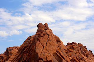
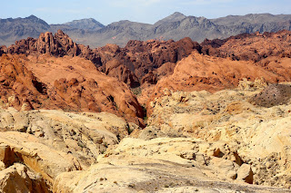
the Valley of Fire, which is a Nevada State Park. While there we saw many
beautiful sites to include the Beehives, Arch Rock, Rainbow Vista and the
Elephant rock. After departing the visitors center Bruce spotted two big horn
sheep, pictures to follow. Here is a little snip it of the Valley of Fire State Park is the oldest state
park in Nevada, USA and was designated as a National Natural Landmark in 1968. It covers an area of almost
42,000 acres and was dedicated in 1935. It derives its name from red
sandstone formations, formed from great shifting sand dunes during the age of
dinosaurs. These features, which are the centerpiece of the park's attractions,
often appear to be on fire when reflecting the sun's rays. Complex
uplifting and faulting of the region, followed by extensive erosion, have
created the present landscape. The rough floor and jagged walls of the park
contain brilliant formations of eroded sandstone and sand
dunes more than 150 million
years old. Other important rock formations include limestones, shales, and conglomerates. Valley of Fire is located 50 miles
(80 km) northeast of Las
Vegas, at an elevation between
2,000–2,600 feet (610–790 m). It abuts the Lake Mead National
Recreation Area at the Virgin River confluence. It lies in a 4 by 6 mi (6.4 by 9.7
km) basin. Here is some info on Las Vegas /lɑːs ˈveɪɡəs/ is the most populous city in the U.S. state of Nevada and the county seat of Clark County.[5] Las Vegas is an internationally renowned
major resort city known
primarily for gambling, shopping, fine dining, and nightlife and is the leading
financial and cultural center for Southern Nevada. The city bills itself as The Entertainment Capital of the
World, and is famous for its
consolidated casino–hotels and associated entertainment. A growing
retirement and family city, Las Vegas is the 31st-most populous city in the United States, with a population at
the 2010 census of
583,756. The 2010 population of the Las Vegas metropolitan area was 1,951,269. Today, Las Vegas is one of
the top tourist destinations in the world.
Established
in 1905, Las Vegas was incorporated as a city in 1911. At the close of the 20th
century, Las Vegas was the most populous American city founded in that century
(a distinction held by Chicago in the 19th century). The city's tolerance for
various forms of adult entertainment earned it the title of Sin City, and this image has made Las Vegas a
popular setting for films and television programs. There are numerous outdoor
lighting displays on Fremont Street, as well as elsewhere in the
city. One of the places that we saw but did not go into was
the Heart Attack Grill, where if you were over 350 lbs or over and a
doctors statement then your meal is free, one of the other things that happen
at the Heart Attack Grill is that if you do not finish your burger than you get
paddled the other thing that is part of the fun is that you have to put on
hospital gown before getting seated. In the early 1990s, the Stratosphere
was conceived by Bob Stupak as an addition to his Vegas World casino.
At the conception of the project, one of the planned rides was to be a giant
ape that would carry riders up and down on one of the tower's columns. The
original plans envisioned the Stratosphere exceeding the height of the CN Tower (1,815 ft
(553 m)) to become the tallest
freestanding structure in the world at that time. However, due
to the FAA's
concerns about possible interference with nearby McCarran International Airport, and any
possible flights that come through Las Vegas, the Tower's proposed height
shrank multiple times, bringing it to its current height of 1,149 ft
(350 m).
On August
29, 1993, the Tower caught fire while still under construction. No one was
injured, but the fire forced repairs and rebuilding that led to numerous delays
in the construction of the Tower.
In
1995, Grand Casinos was brought on as an equity
partner for the still privately funded project under construction. While
construction was still progressing, the Stratosphere Corporation was
formed as a public company with shares being offered to the public.
The
Stratosphere opened on April 30, 1996. Shortly after opening, the Stratosphere
Corporation was forced to file bankruptcy.
This caused construction on the second tower to stop, with only a few stories
partially built, and it allowed Carl Icahn to
gain control through one of his companies by buying a majority of the
outstanding bonds.
A major
addition was completed in June 2001 for $1 billion that included finishing the
1000-room second hotel tower.
In the early
2000s, the company attempted to get approval for a roller coaster that would
run from several hundred feet up the tower and, in the last proposal,
across Las Vegas Boulevard. Part of that last proposal
included an entry monument on the ride over Las Vegas Boulevard welcoming
people to the City of Las Vegas. The Las Vegas City Council did not approve the
project due to objections from the neighbors over possible noise from the
enclosed cars on the proposed ride. Stratosphere Las Vegas is
a tower, hotel, and casino located
on Las Vegas Boulevard just north of
the Las Vegas Strip in Las Vegas, Nevada, United States.
Its tower is also the tallest observation tower, and the 9th-tallest
freestanding structure in the United States, as well as being
the tallest structure in Las Vegas.
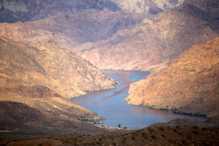
Lake Mead is the largest reservoir in
the United States in maximum water capacity. It is located on the Colorado River about 24 mi
(39 km) from the Strip southeast of Las Vegas,
Nevada, in the states of Nevada and Arizona.
Formed by the Hoover Dam, Lake Mead is 112 miles (180 km) long when the
lake is full, has 550 miles (890 km) of shoreline, is around 1,221.4 feet (372.3
meters) at greatest depth, has 247 square miles (640 km) of surface, and
when filled to capacity, 28 million acre-feet (35 km) of water. However,
the lake has not reached this capacity since 1983 due to increasing
droughts. The lake was named after Elwood Mead (January
16, 1858 – January 26, 1936), who was the commissioner of the U.S. Bureau of Reclamation from 1924
to 1936 during the planning and construction of the Boulder Canyon Project that created
the dam and
lake. Lake Mead was established as the Boulder Dam Recreation Area in 1936,
administrated by the National Park Service. It was then changed to
the Lake Mead National Recreation Area in
1964, this time including Lake Mohave and
the Shivwits Plateau under its jurisdiction. Both lakes and the surrounding
area offer year-round recreation options. The accumulated water from Hoover
Dam forced the evacuation of several
communities, most notably St. Thomas, Nevada, whose last resident left
the town in 1938. The ruins of St. Thomas are sometimes visible when the
water level in Lake Mead drops below normal.
At lower
water levels, a high-water mark or "bathtub ring" is visible in
photos that show the shoreline of Lake Mead. The bathtub ring is white because
of the deposition of minerals on previously submerged
surfaces. There are nine main access points to the lake. On the west
are three roads from the Las Vegas metropolitan area. Access from
the northwest from Interstate 15 is through Valley of Fire
State Park and the Moapa River Indian Reservation to the
Overton arm of the lake.
The lake is
divided into several bodies. The large body closest to the Hoover Dam is
Boulder Basin. The narrow channel, which was once known as Boulder Canyon and
is now known as The Narrows, connects Boulder Basin to Virgin Basin to the
east. The Virgin River and Muddy River empty
into the Overton Arm, which is connected to the northern part of the Virgin
Basin. The next basin to the east is Temple Basin, and following that is Gregg
Basin, which is connected to the Temple Basin by the Virgin Canyon. When the
lake levels are high enough, a section of the lake farther upstream from the
Gregg Basin is flooded, which includes Grand Wash Bay and the Pearce Ferry Bay
and launch ramp. In addition, there are two tiny basins, the Muddy River Inlet
and the Virgin River Basin, that are flooded when the lake is high enough where
these two rivers flow into the lake. As of now, however, these basins remain
dry.
Jagged
mountain ranges surround the lake, offering somewhat of a startling but
beautiful backdrop, especially at sunset. There are two mountain ranges within
view of the Boulder Basin, the River Mountains, oriented north-west to
south-east and the Muddy Mountains, oriented west to north-east. From the
Virgin Basin, you can view the majestic Bonelli Peak towards the east.
After leaving Nellis and Las Vegas we headed to Williams AZ and here is
some info Williams (Havasupai: Wii Gvʼul[1]) is a city
in Coconino County, Arizona, west of Flagstaff. Its population was 3,023 at
the 2010 census. It lies on the
route of Historic Route 66, Interstate 40,
and the Southwest Chief Amtrak train
route. It is also the southern terminus of the Grand Canyon Railway, which takes visitors
to Grand Canyon Village. There are numerous inns,
motels, restaurants and gas stations that cater to the large influx of tourists
rather than local residents, especially during the summer and holiday seasons.
Williams was the last town to have its section of Route 66 bypassed,
due to lawsuits that kept the last section of Interstate 40 in Arizona from being
built around the town. After settlements called for the state to build three
Williams exits, the suits were dropped and I-40 was completed. On
October 13, 1984, Interstate 40 was opened around the town and newspapers the
next day reported the essential end of US 66. The following
year, Route 66 was decommissioned. On the next day we took the train to
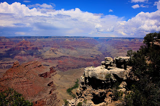
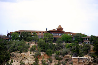
the Grand Canyon more information Grand Canyon National Park is
the United States' 15th oldest national park. Named
a UNESCO World Heritage Site in 1979, the park is
located in Arizona.
The park's central feature is the Grand Canyon,
a gorge of the Colorado River, which is often considered one
of the Seven Natural Wonders of the World. The park
covers 1,217,262 acres (1,902 sq mi; 4,926 km2)
of unincorporated area in Coconino and Mohave counties. Grand Canyon
National Park was named as an official national park in 1919, but the landmark
had been well known to Americans for over thirty years prior. In 1903, President Theodore Roosevelt visited the site and
said: "The Grand Canyon fills me with awe. It is beyond comparison—beyond
description; absolutely unparalleled throughout the wide world... Let this
great wonder of nature remain as it now is. Do nothing to mar its grandeur,
sublimity and loveliness. You cannot improve on it. But what you can do is to
keep it for your children, your children's children, and all who come after
you, as the one great sight which every American should see."
Despite
Roosevelt's enthusiasm and his strong interest in preserving land for public use, the Grand
Canyon was not immediately designated a national park. The first bill to create
Grand Canyon National Park was introduced in 1882 by then-Senator Benjamin
Harrison, which would have made Grand Canyon National Park the
nation's second, after Yellowstone National Park. Harrison
unsuccessfully reintroduced his bill in 1883 and 1886; after his election to the
presidency, he established the Grand Canyon Forest Reserve in 1893. Theodore
Roosevelt created the Grand Canyon Game Preserve by proclamation in
1906 and Grand Canyon National
Monument in 1908. Further Senate bills to establish the site as
a national park were introduced and defeated in 1910 and 1911, before the Grand
Canyon National Park Act was finally signed by President Woodrow Wilson in
1919. The National Park Service, established in 1916,
assumed administration of the park.


